Ruhnu chapels 

According to the old maps, there were three chapels on Ruhnu island already before the completion of the wooden church in the village in 1644. The first of them was located on the east coast of the island and this place is known under the name of Överkirke (Everkirke). There was probably a chapel, which may have been established for the convenience of fishing peasants. From the chapel, they may have showed light to the people on the sea, so that they would know where to come. This chapel is traditionally called Ywerkirka, the Upper church, on the map of 1688 the name of the place is Öster Külch and the leading road is Ueber-kyrswäg. Currently the whole beach between Austerkeld and Norrkeld is named Överkirke. An old chapel may have been located also in the southeast part of the island near Ringsu cape. It is marked on the map of 1688 (Capell el Kärskyrcka) and also on the map of Mellin (Kärs Kapel). In addition Utkirka is also mentioned in the tradition (a church located outside the village) in the west part of the island in the neighbourhood of the cordon and the Pärsi lighthouse, where during the Russwurm’s time iron pieces had been found during ploughing. All three chapels are marked in the middle of the 19th century on the map based on the atlas of Mellin, which Russwurm uses in his book.
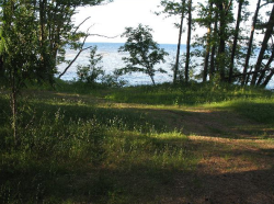 There was probably a chapel on Överkirke beach | 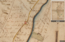 Capell el Kärskyrcka (red house with a cross) on the map of 1688 | 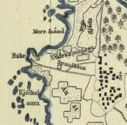 Utkirka is marked on the map of mid 19th century |
Related articles
Created in 2013
 |